Minister for Local Government, Chieftaincy, and Religious Affairs, Ahmed Ibrahim, has stressed the need for licensed surveyors to leverage spatial data for sustainable urban transformation and economic development.
He stated that leveraging spatial data will help in mapping out critical infrastructure such as roads, bridges, drainage systems, and public facilities.
This according to him will ensure strategic placement and efficient use of resources, leading to well-organized urban spaces.
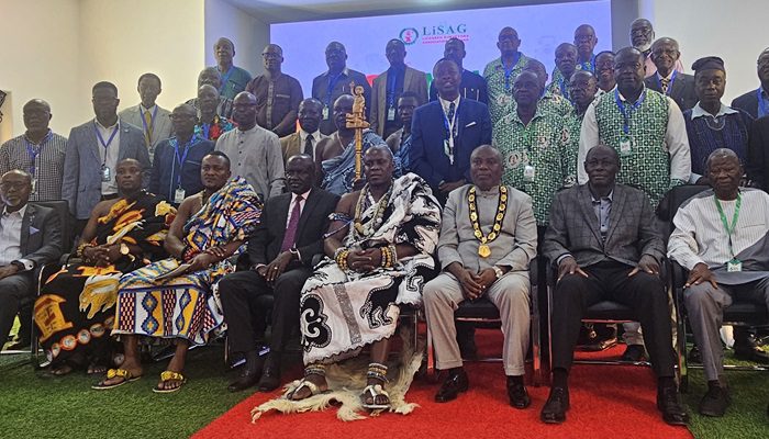
He said this at the 6th Annual General Meeting and Seminar of the Licensed Surveyors Association of Ghana (LiSaG) held at the Lisag house in Labone.
Speaking on behalf of the Minister, Chief Executive Officer of Land Use and Spatial Planning Authority, Dr. Kwadwo Yeboah, noted the critical role of licensed surveyors in shaping Ghana’s urban landscape.
He stated that Ghana’s urbanization rate has increased significantly from 50.9% in 2010 to 56.7% in 2021, posing both challenges and opportunities.
He stressed that rapid urban growth necessitates up-to-date spatial data to guide development, adding that effective land use and spatial planning are essential for sustainable urban environments.
“The National Urban Policy and Urban Global Initiatives have identified spatial planning as a precursor to orderly and sustainable urban development.
Unfortunately, the benefits of land use and spatial planning are not always appreciated. However, it forms the foundation for modern infrastructure and investment in smart cities,” he said.
Dr. Yeboah emphasized the crucial role of basemaps in urban development, explaining that they serve as foundational tools for planning and decision-making.
He stressed their significance in mapping critical infrastructure, ensuring the strategic placement of roads, utilities, and public amenities to enhance accessibility and efficiency.
Well-designed infrastructure planning, he noted, leads to more connected and functional urban spaces, ultimately improving the quality of life for residents.
He further stated the importance of basemaps in disaster risk management, particularly in identifying and mitigating disaster-prone areas such as flood zones and high-risk locations.
“By leveraging spatial data, city planners can implement proactive disaster mitigation strategies, reducing the impact of natural calamities and enhancing urban resilience.
Additionally, basemaps play a key role in land use planning and enforcement, helping authorities regulate zoning laws to ensure orderly urban expansion” he explained.
Effective spatial planning, he stressed, prevents haphazard development and promotes well-structured communities with designated residential, commercial, and industrial zones.
Dr. Yeboah urged surveyors to embrace advanced technology, such as artificial intelligence and digital mapping platforms, to improve land administration and urban planning.
He cited examples like Mumbai’s coastal route project, where digital basemaps optimized costs and improved efficiency in construction.
He also emphasized the economic benefits of accurate spatial data, including attracting investments, improving land revenue systems, and enhancing tourism.
However, he acknowledged challenges such as outdated data, limited access to modern technology, and inadequate collaboration among stakeholders.
“It is crucial that we prioritize policies that support spatial data infrastructure and encourage investment in modern mapping technologies. The digital transformation presents an opportunity to overcome these challenges,” he added.
Dr. Yeboah reaffirmed the government’s commitment to supporting initiatives that enhance spatial planning and land administration.
He also called for collaboration between the Licensed Surveyors Association of Ghana and other agencies to implement recommendations from the 2021 Technical Report on District Boundary Disputes.
The Chairman of the occasion, Licensed Surveyor, Francis Manu Adabor, underscored the critical role of surveyors in shaping the country’s urban landscape and economic development.
He emphasized the need for innovation and collaboration to enhance spatial planning and infrastructure development.
“Our theme is leveraging basemaps for urban transformation and economic growth. This serves as a timely reminder of the crucial role we play in shaping the future of our nation,” he stated.
Mr. Adabor commended the partnership between the Licensed Surveyors Association, the Lands Commission, and GMS Services Limited.
He noted that the collaboration has led to the establishment of a comprehensive, continuously operating reference station infrastructure, which he described as a significant milestone for the surveying profession and the nation’s socioeconomic advancement.
“Basemaps are the foundation upon which urban transformation and economic growth are built. They provide a spatial framework for planning, decision-making, and investment,” he said.
He further called on surveyors to embrace innovation and technology, particularly geospatial solutions, to drive sustainable urban development.
He emphasized the importance of using smart mapping techniques to create smart cities, improve transportation systems, and develop sustainable environments.
The Paramount Chief of the Yilo Krobo Traditional Area, Oklepeme Nuer Annorbaah Sasraku II, also emphasized the crucial role of traditional authorities in land governance and urban transformation, calling for their full inclusion in land management policies and initiatives
He called for ethical practices in land surveying and raised concerns over unethical conduct by some surveyors, citing cases where lands were being measured at night using lanterns and torchlights.
“If you do not crack down on corrupt surveyors—whether licensed or not—it will undermine your efforts and create mistrust among landowners. Traditional rulers protect their lands fiercely, as they were acquired through the sacrifices of our ancestors,” he said.
He warned that unethical land dealings create a perception that authorities are attempting to seize lands from communities, thereby hindering cooperation with surveyors and other stakeholders.
By CHRISTABEL OBOSHIE ANNAN, Accra
- Commonwealth lawyers demand reversal of CJ’s suspension - 10 May 2025
- Cedi to resume depreciation in late 2025, S&P warns - 10 May 2025
- Debt restructuring, IMF deal, gold surge propel Ghana to S&P Upgrade - 10 May 2025